Executive Summary
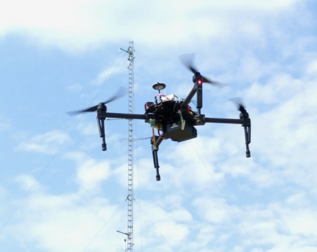
Linköping University has partnered with Sparv Embedded AB to equip a drone with a high-performance methane (CH₄) sensor and the Sparvio data-logging suite for rapid mapping of emission hotspots. This turnkey UAV platform records methane concentrations alongside wind speed, air pressure, GPS position, orientation, speed, temperature, and humidity—all synchronized, timestamped, and logged onboard. Real-time telemetry lets operators view live graphs via a ground station. A 2021 study in ACS Earth and Space Chemistry demonstrated that drone-based wind measurements uncover atmospheric variations undetected by ground stations, enhancing flux calculations. By combining horizontal flight patterns for hotspot localization and vertical profiles for mass-balance flux estimation, the system quantified 178.4 ± 8.1 kg CH₄/day from a wastewater sludge deposit. As European resellers of Aeris Technologies’ high-resolution gas sensors (CH₄, CO, CO₂, N₂O) and Anemoment wind instruments, Sparv Embedded continues refining this solution to fill critical gaps in greenhouse-gas source attribution.
Key Learnings
- Drone-based CH₄ mapping captures emission hotspots with 1 Hz precision of 0.84 ppb.
- Onboard wind measurements (0.1 m/s precision) reveal atmospheric variations missed by ground stations.
- Horizontal flight legs locate sources; vertical profiles enable flux estimates via mass-balance.
- The system logged 178.4 ± 8.1 kg CH₄/day from a sludge deposit using three 10-minute flights.
- Integrated Sparvio suite records methane, winds, pressure, GPS, orientation, speed, temperature, and humidity.
- Real-time radio telemetry provides live graphing at a ground station.
- Modular resale partnerships extend capabilities to CO, CO₂, N₂O sensors and advanced wind instruments.
Introduction to Drone-Based Methane Mapping
Methane is a potent greenhouse gas with poorly constrained emission sources. Traditional ground-station networks lack spatial resolution to locate and quantify leaks over complex landscapes. By mounting a fast-response CH₄ sensor on a lightweight drone platform, researchers can now map concentration plumes in near real-time, pinpointing emission hotspots for targeted mitigation.
Onboard Sensor Suite and Data Logging
The Sparvio system integrates:
- A laser-absorption methane analyzer (precision 0.84 ppb at 1 Hz)
- Anemoment ultrasonic wind sensor (precision 0.1 m/s)
- Barometric pressure transducer
- GPS for position and speed
- Inertial measurement for orientation
- Temperature and humidity probes
All channels are timestamped, logged to onboard memory, and broadcast via radio to a ground-station interface for live monitoring and post-flight analysis.
Flight Methodology and Data Transmission
- Horizontal Grids: Sequential passes at constant altitude map methane concentration fields.
- Vertical Profiles: Ascents and descents through plumes support mass-balance calculations of total CH₄ flux.
- Telemetry: Low-latency radio link streams data to the operator’s laptop, displaying real-time dashboards of CH₄ levels and wind vectors.
Key Findings from ACS Earth & Space Chemistry Study
A 2021 article demonstrated that:
- Drone-recorded wind speeds at altitudes up to 23 m showed variability absent in nearby weather-station logs.
- Mass-balance calculations over a sludge deposit yielded a mean flux of 178.4 ± 8.1 kg CH₄/day, validating the method’s accuracy for complex sources.
- Fully onboard measurements removed the need for supplementary ground instruments, streamlining field deployment.
Sparvio System and Platform Integration
Designed for plug-and-play use in UAVs, labs, environmental surveys, and education, the Sparvio suite delivers:
- Rapid start-up with no custom firmware or hardware integration required
- Modular expansion ports for additional gas or meteorological sensors
- Cross-platform data export in CSV and JSON for GIS and statistical analysis
Partnerships & Reseller Information
Sparv Embedded AB is the exclusive European reseller for:
- Aeris Technologies’ high-resolution gas sensors (CH₄, CO, CO₂, N₂O)
- Anemoment ultrasonic wind sensors
Comprehensive support includes calibration services, firmware updates, and system training.
Future Directions
Ongoing developments aim to:
- Miniaturize sensor modules for smaller UAVs
- Integrate machine-learning algorithms for automated plume detection
- Expand spectral sensing to additional trace gases (e.g., ethane, propane)
Sources
- Sparv Embedded AB. “Mapping methane emissions.” April 21, 2022. https://sparvembedded.com/blog/mapping-methane-emissions
- Magnus Gålfalk, Sören Nilsson-Påledal, David Bastviken. “Sensitive drone mapping of methane emissions without the need for supplementary ground-based measurements.” ACS Earth and Space Chemistry 2021, 5, 2668–2676. DOI: 10.1021/acsearthspacechem.1c00106
About the author

Mattias Wilzén
Head of Finance & Customer Accounts
Oversees financial performance and ensures smooth operations for our customers, from order to delivery and ongoing support.